
Arapahoe County CO Property Tax and Hazard by ZIP Code
Discover how Arapahoe County, Colorado property taxes work by ZIP code. Learn about value, classification, assessment rates, and local districts.
9 min read1,730 wordsZip Cost Ledger editorial
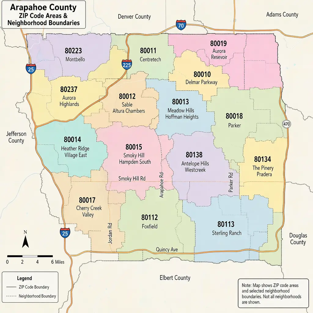
If you are researching Arapahoe County, Colorado — property tax and hazard by ZIP code, the first thing to know is that ZIP codes are useful for organizing a search, but they do not set your tax bill by themselves. Arapahoe County property tax is based on your property’s value, its classification, and the taxing districts attached to the parcel. ZIP-level hazard review is also helpful, especially for flooding, wildfire, severe weather, and insurance planning, but the most accurate answer always comes from the specific address.
How do Arapahoe County property taxes work by ZIP code?
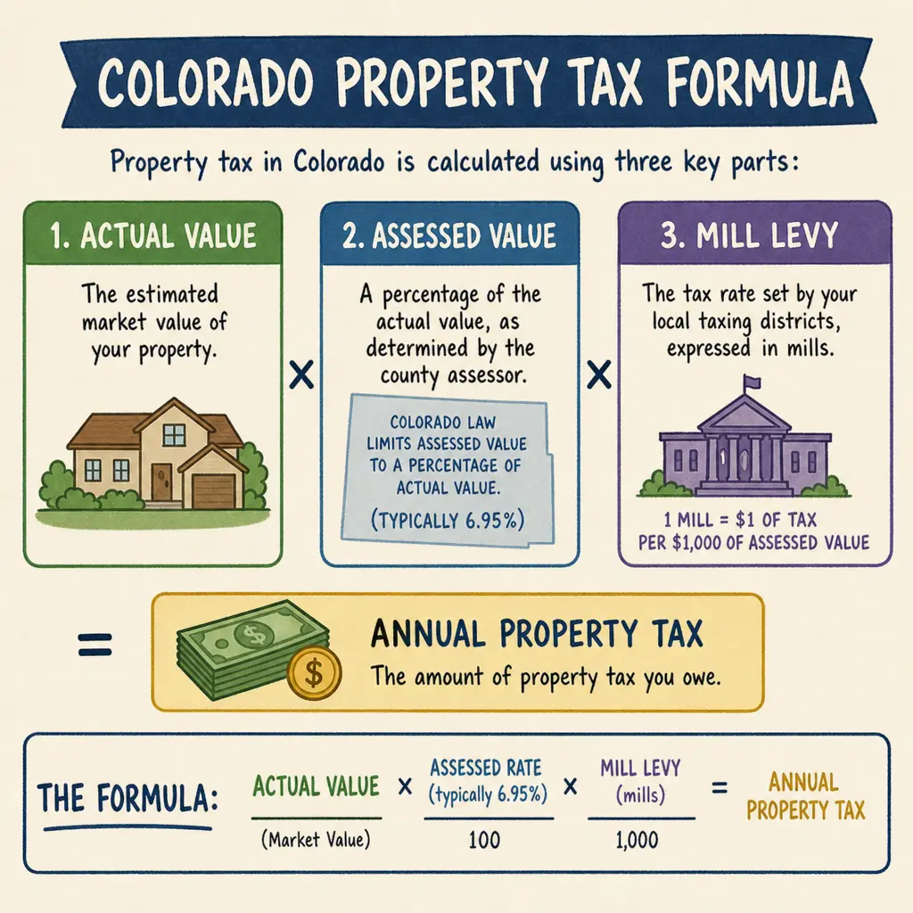
Arapahoe County taxes are calculated at the parcel level, not simply by ZIP code. A ZIP code can point you toward a city, neighborhood, or school district pattern, but two homes in the same ZIP may have different property tax rates if they fall into different school, fire, library, metro, water, sanitation, or improvement districts. Colorado’s basic property tax formula is actual value multiplied by the assessment rate, then multiplied by the mill levy; Arapahoe County’s own FAQ describes the same relationship and notes that each property’s value and mill levy may differ. (files.arapahoeco.gov)
That distinction matters in Colorado zip codes that cross municipal or district boundaries. A ZIP such as 80015, 80016, 80111, 80112, 80120, or 80122 may give you a useful starting point, but it should not be treated as a final tax jurisdiction. For a real estimate, search the address or parcel identification number through the county’s property tax tools, then review the taxing authorities listed on the statement.
ZIP code taxes are really district taxes
The phrase “zip code taxes” is common, but it can be misleading. ZIP codes were built for mail delivery, while property taxes are built around taxing authorities. In Arapahoe County, those authorities may include the county, a municipality, a school district, and multiple special districts depending on where the property sits.
Arapahoe County publishes mill levy and tax district information because local tax bills can involve many overlapping districts. The county’s assessor resources also explain that levying taxes is handled by taxing authorities within each taxing district, not by the Assessor alone. (files.arapahoeco.gov)
When comparing tax by ZIP code, think of the ZIP as a filter, not the rule. It helps you narrow the search area, but the tax statement tells you which districts actually apply.
Useful details to compare include:
- Actual value: the market value assigned by the Assessor.
- Property classification: residential, commercial, vacant land, agricultural, or another class.
- Assessment rate: the percentage of actual value used to create assessed value.
- Mill levy: the combined tax rate from applicable taxing authorities.
- Special districts: metro districts, fire districts, water and sanitation districts, libraries, parks, and similar authorities.
- Exemptions or deferrals: programs that may reduce or delay taxes for qualifying owners.
The main factors behind your Arapahoe County property tax bill
A property tax bill can rise or fall for several reasons, and the ZIP code is usually only the surface-level clue. The deeper drivers are value, assessment rules, and district levies.
Property value changes
Colorado law requires county assessors to reappraise real property every two years during odd-numbered years, according to Arapahoe County’s FAQ. That means a new valuation cycle can change your taxable base even if the local mill levy does not move much. (files.arapahoeco.gov)
Value changes are especially important in active housing markets. A home in a fast-appreciating part of Aurora, Centennial, Littleton, Englewood, or Greenwood Village may see a different valuation change than a similar-sized property elsewhere in the county. The Assessor compares properties using factors such as location, design, size, age, amenities, and relevant sales information.
Assessment rates
Colorado property tax uses assessment rates to convert actual value into assessed value. For 2026, the Colorado Division of Property Taxation lists separate residential assessment rates for local government and schools, with residential local government at 6.8% and residential schools at 7.05%. (spl.cde.state.co.us)
This matters because a tax statement may no longer feel like one simple calculation. School taxes and local government taxes can be calculated using different assessed values, then added together for the total bill.
Mill levies and local districts
A mill levy is the tax rate applied to assessed value. One mill equals one dollar of tax per $1,000 of assessed value. Arapahoe County’s Treasurer explains that property tax revenue is collected and distributed to the county and other public entities, including school districts, while the Assessor’s FAQ notes that school, county, fire, water, sanitation, library, recreation, and metro districts can all be taxing authorities. (files.arapahoeco.gov)
That is why two properties with similar values can have different tax bills. One may sit inside a metro district with added infrastructure obligations, while another may not. One may be in a different school district or municipality. These differences are easy to miss if you only compare by ZIP.
What should you check before comparing property tax rates?
Before comparing property tax rates across Arapahoe County, verify that you are comparing the same kind of property and the same level of detail. A ZIP-level average can be useful for broad planning, but a parcel-level statement is better for buying, selling, budgeting, or appealing a valuation.
Use this checklist when researching arapahoe county property tax by ZIP:
- Start with the property address. Use the county’s tax search or property search tools instead of relying only on a ZIP code.
- Confirm the city or unincorporated area. A mailing city does not always match the taxing jurisdiction.
- Review the listed taxing authorities. Look for school districts, metro districts, fire districts, libraries, and water or sanitation providers.
- Check the assessed value, not only market value. Taxes are based on assessed value after the applicable Colorado property tax assessment rate is applied.
- Compare mill levies carefully. A higher-value home with a lower mill levy can still owe more than a lower-value home with a higher mill levy.
- Look for exemptions or deferrals. Senior, veteran, disability, or military-related programs may affect eligible taxpayers.
- Confirm the current tax year. Assessment rates, valuations, and levies can change, so older examples may not reflect the current bill.
Arapahoe County’s online tax search allows users to find residential real estate, personal property, and state-assessed tax information by PIN, AIN, or address, which makes it the best starting point for a parcel-specific answer. (taxsearch.arapahoegov.com)
Hazards by ZIP code add another layer to property research
Property taxes are only one part of understanding a location. Hazard exposure can influence insurance, maintenance costs, emergency planning, long-term resale considerations, and the kinds of questions buyers should ask before closing. In Arapahoe County, hazard review may include flood exposure, wildfire risk, severe storms, winter weather, hazardous materials concerns, and other all-hazards planning issues.
The county’s Office of Emergency Management says its Hazard Mitigation Plan describes natural hazard threats in Arapahoe County and mitigation strategies, while its Community Wildfire Protection Plan addresses wildfire risk and steps communities can take to reduce it. (files.arapahoeco.gov)
A ZIP code can help you begin that review because hazards often cluster geographically. A property near a creek, drainage corridor, open space edge, grassland interface, or major transportation corridor may have a different risk profile than another property in the same city. Still, as with taxes, the most useful hazard research is address-specific.
For a more complete view, check:
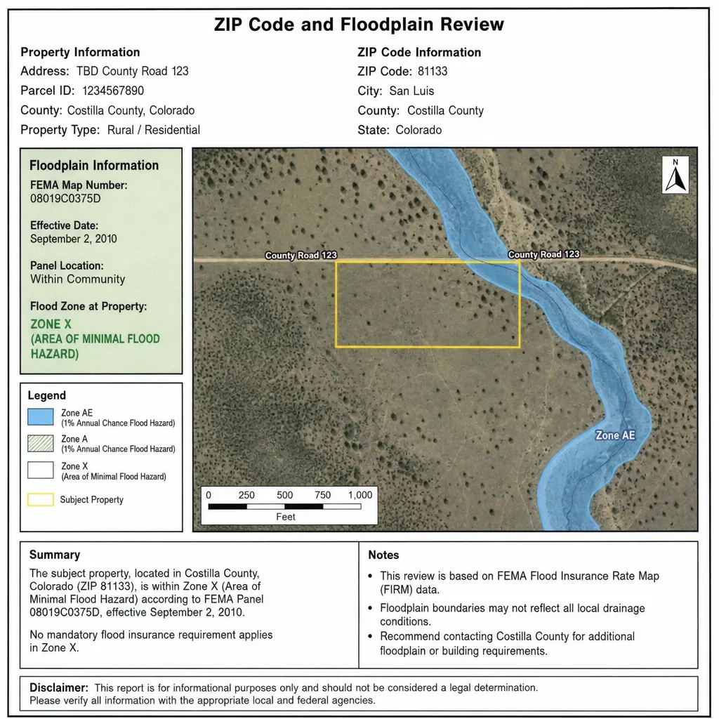
- FEMA flood map information for the exact address.
- County or municipal drainage and stormwater resources.
- Wildfire planning resources for grassland or open-space-adjacent areas.
- Local emergency alert systems and evacuation information.
- Insurance quotes that reflect the property’s actual location and features.
- HOA or metro district documents related to drainage, open space, snow removal, or infrastructure.
Common mistakes when using tax by ZIP code
The biggest mistake is assuming that every property in one ZIP has the same tax burden. That may be directionally useful for a quick screen, but it can be wrong for a specific home. A single ZIP can include multiple municipalities, school districts, and special districts.
Another mistake is comparing only the total bill without asking why it differs. A higher bill could reflect higher property value, a different assessment class, additional taxing districts, or a recently changed valuation. The Assessor’s office handles value and classification, but objections to the level of taxation must be directed to the taxing authorities, according to Arapahoe County’s FAQ. (files.arapahoeco.gov)
A third mistake is ignoring timing. Property tax notices are generally mailed after the start of the year, and Colorado tax bills reflect taxes due for the preceding year. The state’s property tax guide notes that bills are mailed as soon after January 1 as possible and outlines typical payment timing for full or half payments. (spl.cde.state.co.us)
A practical way to compare Arapahoe County ZIPs
If you are comparing homes across Arapahoe County, build your review from broad to specific. Start with ZIP code, then move quickly to parcel-level facts. This keeps the convenience of ZIP-level searching without letting it oversimplify the decision.
A practical workflow looks like this:
- Pick the Colorado zip codes you are considering.
- Identify sample properties in each ZIP with similar value, size, and property type.
- Pull the county tax record for each address.
- Compare actual value, assessed value, total mill levy, and listed taxing authorities.
- Note any metro district or special district differences.
- Review flood, wildfire, and severe-weather planning resources for each address.
- Ask your agent, lender, insurance professional, or tax adviser about anything that looks unusual.
This approach is especially helpful for buyers moving between ZIP codes in Aurora, Centennial, Littleton, Englewood, Sheridan, and eastern Arapahoe County. It also helps current homeowners understand why a neighbor in a nearby ZIP—or even across a street—may have a different bill.
The takeaway for homeowners and buyers
Arapahoe County property tax is best understood by address, not by ZIP code alone. ZIP codes help organize research, but actual arapahoe county taxes depend on value, classification, assessment rates, mill levies, and the exact taxing districts tied to the parcel.
For the clearest answer, use ZIP codes as a starting point, then verify the parcel through official county tools and review the full tax statement. If you are also weighing hazard exposure, pair tax research with address-specific flood, wildfire, and emergency planning resources. That combination gives you a more realistic picture of ownership costs, local services, and property risk before you make a decision.
Related guides
Mesa County Property Tax & Hazard Guide by ZIP
Mesa County property taxes are based on a Colorado assessment system, not a single countywide percentage you can apply to every home. Your bill depends on your property’s actual value, its assessed value, the taxing districts tied to the parcel, and any applicable local or special district levies.
· 9 min read
Boulder County Property Tax Guide: Rates & Hazards by ZIP
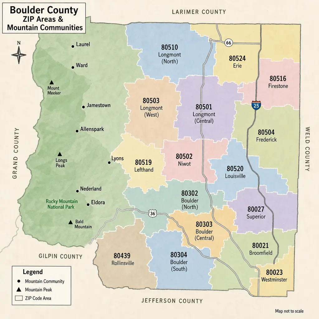
Boulder County property taxes can look different from one ZIP code to the next, but ZIP codes are only a starting point. The real bill is driven by a property’s actual value, Colorado assessment rules, and the specific school, city, fire, library, water, and special districts tied to that parcel. This guide explains how to read Boulder County taxes by area, how hazard considerations fit into the picture, and what to check before buying, budgeting, or comparing homes.
· 9 min read
Morgan County Property Tax & Hazard Guide: ZIP Code Insights
Property taxes in Morgan County, Colorado are shaped by your property’s actual value, its state-defined assessment rate, and the mill levies charged by the county, school district, municipality, and special districts that serve your parcel. That is why two properties with similar market values can have different bills when they sit in different tax areas, school boundaries, or service districts. This guide explains how Morgan County property tax works, how to read property tax rates, and why pairing tax by ZIP with a hazard assessment can give homeowners, buyers, and investors a clearer view of total property risk.
· 9 min read